How the IGNOU MGGL 005 Practical is done, start to finish
The IGNOU MGGL 005 Practical asks you to carry out 29 remote sensing exercises in QGIS over a 14-day lab block, turn each Make It Yourself task into a dated record entry, and explain that record at the Day 14 examination and viva-voce. This guide shows the working method for MSCGG learners, one exercise at a time.
MGGL-005 in five lines
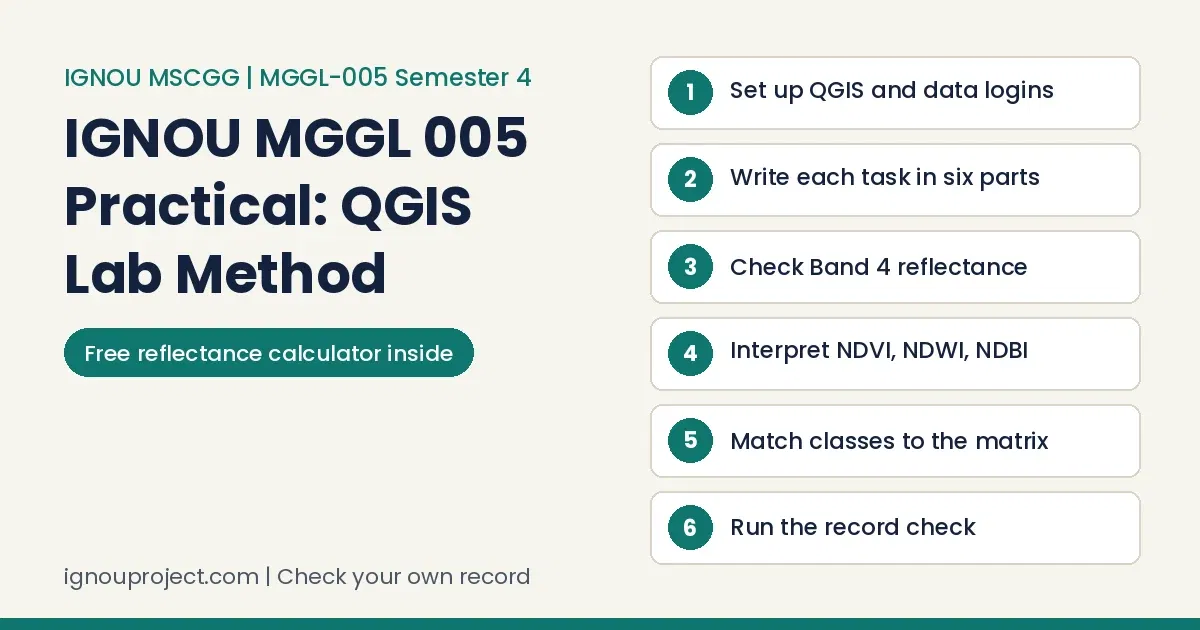
To complete the IGNOU MGGL 005 Practical: set up QGIS and the data logins before Day 1, run each exercise on your own or the centre’s image, write one entry per task with the expression and output map, check the numbers, finish the record on Day 13, then rehearse for the Day 14 paper and viva.
Everything below follows the February 2026 course book, which pairs the lab with MGG-012 and asks for at least 70 percent attendance across the 28 lab sessions. Keep it open beside QGIS.
Set up QGIS, data logins and one folder per exercise before Day 1
Most lost lab hours in the IGNOU MGGL 005 Practical come from setup, not from the methods. Do these five things at home in the week before your batch starts:
- Install QGIS and the plugins. Install the latest QGIS and the Semi-Automatic Classification Plugin (SCP) as Exercise 1 shows, then Profile Tool, QuickMapServices and QuickOSM.
- Register on the data portals. Exercise 2 needs a login on Bhoonidhi and on USGS EarthExplorer, which will not let you download a scene until you sign in. Sentinel-2 scenes for Exercises 6, 24 and 25 come from the Copernicus Data Space Ecosystem.
- Keep the metadata. A Landsat-8 download arrives with its MTL.txt file. Exercise 7 cannot be done without it, so never delete it to save space.
- Make one folder per exercise. Name them Ex01 to Ex29 and save every output inside, for example Ex12/NDVI.tif.
- Prepare an area of interest. Several exercises clip to an AOI shapefile, so make one boundary and reuse it.
Writing one record entry in six parts
Your remote sensing practical record grows task by task: each exercise ends with one or more Make It Yourself tasks, 41 in all from 1.1 to 29.1. For the IGNOU MGGL 005 Practical, write every task as one entry with these six parts.
Six parts of an entry
- Task and date: the task number and wording (for example 12.2) and the lab day you did it.
- Aim: one sentence in your own words on what the method shows.
- Data: sensor, scene date, bands used and where the image came from (a portal or the dataset given at your study centre).
- Steps: numbered, with menu paths and each expression exactly as typed.
- Output: the map or chart with a title, legend, scale and north arrow, plus any table of values.
- Reading: a few lines on what the output shows and one on errors or limits.
Across practical courses, a log written in one evening shows itself: sentences repeat, entries land on days the lab was closed, and nothing improves from the first page to the last. The MGGL-005 day table gives each of the 13 working days its own exercises, so date every entry to the lab day it belongs to.
Reports often lose marks simply because one expected part, such as the method or the result, is missing. The MGGL-005 book prints no report sequence of its own, but most of its exercises set out requirements and the data source before the procedure, and an entry in that order mirrors the book.
In our experience the record is where most marks slip away, and it is also the part easiest to repair before hand-over. For MGGL-005 the second session of Day 13 is set aside for preparing and finalising the records, so use it to repair, not to start.
Worked example: absolute atmospheric correction in QGIS for Band 4
In Exercise 7 of the IGNOU MGGL 005 Practical one wrong constant spoils the whole map, so here is one pixel worked by hand with the Landsat-8 Band 4 values the book prints from its MTL.txt file (scene of 19 January 2018). The DN of 10,000 is illustrative.
Band 4 worked from the book’s MTL table
| Step | Working | Result |
|---|---|---|
| 1. Read the constants | Radiance multiplier 0.010319; radiance add -51.59555; Earth-Sun distance 0.983962 AU; sun elevation 34.03563906 degrees; ESUN for Band 4 1547 | Written in the entry |
| 2. Sun zenith | 90 – 34.03563906; cosine taken in radians (x 3.1416 / 180) | 55.96436 degrees; cos = 0.559707 |
| 3. DN to TOA radiance | 0.010319 x 10,000 – 51.59555 | 51.59445 |
| 4. Remove path radiance | 51.59445 – (-51.5), the value used in the book’s expression | 103.09445 |
| 5. Numerator | 103.09445 x 0.968181 (distance squared) x 3.1416 | 313.576 |
| 6. Denominator | 1547 x 0.559707 | 865.866 |
| 7. Surface reflectance | 313.576 / 865.866 | 0.3622 |
Read 0.3622 against the book’s reflectance table: 0.05 to 0.4 covers natural surfaces such as soil, vegetation and water, so the pixel is plausible. If your hand figure and the Identify value on the Surface_Reflectance raster differ, the expression has a typing slip. Put the hand check in your task 7.1 entry.
Lab records we see often drop the observation table, stop a calculation halfway or leave out any line on sources of error. Exercise 7 hands you that line: the book notes that reflectance above 1.0 can come from sensor saturation, specular reflection or calibration and correction errors.
Free Band 4 reflectance calculator
Check one pixel of your own Exercise 7 output: replace the book’s values with those in your MTL.txt and the DN from your image.
Band 4 reflectance calculator
DN Radiance multiplier Radiance add
Path radiance Earth-Sun distance (AU) Sun elevation (degrees) ESUN
With the values shown: radiance 51.59445, sun zenith 55.96436 degrees, surface reflectance 0.3622
Writing up NDVI in QGIS, with NDWI and NDBI beside it
Task 12.2 of the IGNOU MGGL 005 Practical asks you to run all three indices and interpret the maps, and 12.1 asks for the differences between them. Build the write-up in this order.
- Name the bands. In the book’s Landsat 9 steps NIR is band 5, red band 4, green band 3 and SWIR band 6. Rename the layers before you open the Raster Calculator so the expression reads clearly.
- Write each expression as typed. NDVI is (“band5@1” – “band4@1”) / (“band5@1” + “band4@1”); NDWI is (“band3@1” – “band5@1”) / (“band3@1” + “band5@1”); NDBI contrasts SWIR with NIR as the book shows.
- Record your own range. The book’s NDVI image ran from -0.140817 to 0.516008 and its NDWI image from -0.460586 to 0.144526. Yours will differ; copy the minimum and maximum from your layer properties, not from the book.
- Classify the symbology. Singleband pseudocolor with Discrete interpolation, as the book sets it, then a legend whose class breaks match the reading you write.
- Interpret on the ground. Name a real place in your AOI for each class, such as the fields where NDVI is high or the built-up area where NDBI turns positive.
Across practical courses, weak entries repeat the action while evaluators look for the link between the action and a course idea. The MGGL-005 book gives that link for NDVI in plain numbers: values below 0 read as water or urban area and 0.2 to 0.6 as healthy vegetation, so tie each class on your map to a reading of that kind.
One image, four exercises: classification to error matrix
Exercises 17 to 22 of the IGNOU MGGL 005 Practical form one chain, and a break early in it shows only at the end. The book’s sample is a Landsat 5 TM image of 25-12-2010; Exercises 18 and 20 repeat the methods on a second image.
- Exercise 17, unsupervised: run SCP clustering, then reclassify the clusters into named land use and land cover classes. Fix the class list here.
- Exercise 19, supervised: draw training samples for the same class list and produce a final map layout (task 19.1 asks for it).
- Exercise 21, reference polygons: on a base map, draw polygons for each class with an ID and name in the attribute table, and save the layer edits.
- Exercise 22, accuracy: open SCP, Post Processing, Accuracy, and record overall accuracy, producer’s accuracy (omission error) and user’s accuracy (commission error) for both maps.
Keep class names and codes identical in all four. If Exercise 19 says “Built-up” and the Exercise 21 polygons say “Settlement”, the error matrix will not line up.
Computer practical records often carry a procedure with no output, or an output that does not match the settings written above it. Task 19.1 asks for a final layout of the classified map, so that layout is the output that proves your run.
Seven IGNOU MGGL 005 Practical mistakes and how to fix each
- Two additive values in Exercise 7. The DN-to-radiance step prints -50.06477, while the MTL table and the reflectance expression use -51.59555; the example pixel then gives 0.3675, not 0.3622. Fix: take RADIANCE_ADD_BAND_4 from your own MTL.txt and name it in the entry.
- Degrees fed to the cosine. The Raster Calculator cosine works in radians. Fix: keep the book’s “x 3.1416 / 180” inside cos() and remember the zenith is 90 minus the sun elevation.
- Band numbers carried across sensors. The FCC is 5-4-3 for Landsat but 8-4-3 for Sentinel-2 (task 4.3). Fix: write the sensor beside every band combination.
- Book ranges copied as your result. Fix: report the minimum and maximum of your own output layer and write the interpretation from those.
- Mismatched weights in Exercise 29. The weight table shows geology as 15 percent but 0.20, and geomorphology as 20 percent but 0.15, while the expression uses the decimals. The book says all layer weights must equal 100. Fix: choose one set, make the table and the expression agree, and check they add to 100.
- The drainage density unit step. Exercise 29 says to divide the layer by 1000 but the expression printed is Draiangedensity*1000. Fix: decide the unit with your counsellor and write it on the legend.
- Assumed station readings. Exercises 26 and 28 start from air or water quality values at real sampling stations. Fix: name the source and date of each value.
In experiment-based practicals we often see a wrong reference value carried straight into the result. In MGGL-005 the Exercise 29 weight table, with its two mismatched rows, is a place where that can happen.
Rehearsing the three-hour paper and the viva on Day 14
Day 14 of the IGNOU MGGL 005 Practical is printed as the evaluation, practical examination and viva-voce. The term-end papers run 3 hours for 50 marks with any five questions, so plan about 36 minutes for each answer, including the output map. The June 2025 Set-I paper also asked for output maps wherever applicable and neatly written procedural steps.
Rehearse each answer as aim, data, numbered steps, output and a two-line reading. The June 2026 Set-I paper included supervised classification, groundwater potential zone steps and radiometric correction using histogram equalization; time yourself on two such questions at home.
MGGL 005 viva questions to practise
Practice prompts drawn from the exercises, not a list issued by IGNOU:
- Why does vegetation look red in a 5-4-3 Landsat FCC?
- Which constants did you take from MTL.txt in Exercise 7, and why is the Earth-Sun distance squared?
- Why does NDWI use the green and NIR bands?
- What is the difference between producer’s and user’s accuracy in your error matrix?
- What did ground truthing change on your Exercise 16 map?
- Why must the overlay weights in Exercise 29 add up to 100?
Learners often treat the viva as a formality, yet it usually counts for a good deal: a tidy record earns little when its owner cannot say why a step was taken, and those who did the work answer with ease. MGGL-005 places its viva-voce on the same day as the practical examination.
Check your record against twelve points
Run this list on the evening of Day 12, so the Day 13 record session goes on fixing, not discovering.
Record check before Day 13 closes
- Every lab day from 1 to 13 has dated entries.
- Each entry names the sensor, scene date, bands and data source.
- Every Raster Calculator expression sits beside the map it produced.
- Exercise 7 constants come from your own MTL.txt, with one pixel checked by hand.
- Exercise 4 histograms and Exercise 5 spectral profiles have labelled axes and band names.
- Exercise 12 maps show your own value range and a legend that matches your reading.
- Written tasks (5.1, 5.2, 11.3, 12.1, 12.2) have answers in full sentences.
- Exercise 16 shows the interpretation key, the Level II classes and what ground truthing corrected.
- Classified maps from Exercises 17 to 20 have final layouts and the same class names as the Exercise 21 polygons.
- Exercise 22 gives overall, producer’s and user’s accuracy for both maps.
- Application exercise weights add up to 100 in the table and the expression, and station data carry a source.
- The cover shows MGGL-005 Remote Sensing Techniques, M.Sc. (Geography) (MSCGG), your enrolment number and study centre, in the form your counsellor asks for.
A counsellor certificate left without a signature is something we come across often. The MGGL-005 book lists no certificate, so ask your counsellor whether your centre adds one and, if it does, get it signed during the lab block.
Send your own IGNOU MGGL 005 Practical record for a check
If you have written your IGNOU MGGL 005 Practical entries and want a second reader before Day 13, send scans of your own record on WhatsApp. We read it against the course book, mark missing parts, wrong constants, unlabelled outputs and unsupported readings, and return comments for you to correct. We do not run your exercises or make your maps. The services and the prices printed for them are listed on our services and charges page, and a record check is quoted on WhatsApp at +91 93546 37830 (Monday to Saturday, 9:00 am to 6:00 pm).
Learners who keep no acknowledgement have nothing to point to if marks go missing later. The book names the academic counsellor or lab instructor as the person who takes the record, so ask for a dated signature on your own copy at hand-over.
Questions learners ask while doing the lab
Can I use the study centre’s dataset instead of my own download?
Yes. Exercises 3 to 14 and 23 to 29 say you can use the dataset given at your study centre, while Exercise 2 teaches you to download your own. Say in each entry which one you used.
Which QGIS version does the IGNOU MGGL 005 Practical need?
The book asks for the latest version of QGIS and builds many exercises on SCP. Install both before Day 1 and keep that version through the fortnight, since menu names can shift between releases.
What if a tool shown in the book is missing from my QGIS?
Exercise 11 already warns that the SCP preprocessing tool may be missing in some versions and falls back on the Raster Calculator. For other gaps, use a route your counsellor accepts and note it in the entry.
Finishing the IGNOU MGGL 005 Practical in MSCGG semester four
The IGNOU MGGL 005 Practical rewards steady work: setup before Day 1, one honest entry a task, numbers checked by hand and a record you can talk through. Semester four also carries MGG-012, an elective and the MGGP-001 project, so close each day’s entries before you leave the centre. If you want printed theory notes for the paired course, see the reference material for this course on our publication site.
The learners who do well begin early, confirm what their own centre expects, date an entry for each lab day, gather signatures along the way and can explain every page without notes. For MGGL-005 that means 13 dated days of work and a record you can defend on Day 14.
Official documents behind this guide
- Course book: MGGL-005 Remote Sensing Techniques, laboratory course of the IGNOU School of Sciences, printed February 2026, ISBN 978-93-6106-574-3 (also listed on eGyanKosh under MSCGG Semester-IV)
- MGGL-005 term-end practical papers: June 2025 Set-I and June 2026 Set-I
- Data portals named in the book: USGS EarthExplorer and the Copernicus Data Space Ecosystem
ignouproject.com is not affiliated with, authorised by or endorsed by IGNOU. We check and comment on the learner’s own record; the learner remains the author of every entry, map and reading in it.

BK Sahni iD 0009-0005-8092-459X
Founder, Shri Chakradhar Publication Pvt. Ltd. & ignouproject.com — helping IGNOU distance-learning students since 2010 (5,00,000+ students supported across MBA, MCom, MA & more). Author of IGNOU exam guides, solved assignments & project reference books.
Disclosure: Shri Chakradhar Publication Pvt. Ltd. and ignouproject.com are independent third-party study-help services — not the official IGNOU website. Always verify final dates and rules on ignou.ac.in.